How to Ride the New York City Subway

In the depths of New York City lies one of the world's oldest subway systems. It was built in 1904 and operates 24/7, seven days a week, seamlessly connecting the boroughs of Manhattan, Brooklyn, Queens, and the Bronx. Although Staten Island also has a subway line, it requires a ferry ride.
The New York City subway is one of the most efficient ways to travel around the city. In this video, I'll guide you through understanding why subway lines are grouped and how to differentiate between local and express trains. We'll explore the subway map and learn how to read it effectively. Additionally, we'll tackle the inconsistent signage system found in the New York City subway.

These are the subway lines of the New York City subway. While they may seem peculiar in their grouping and random with their multiple colors and alphanumeric labels, this arrangement results from decades of reordering and reshuffling.
To understand this grouping, we must know that the current New York City subway system was built by three independent subway companies: the Independent Subway System, the Brooklyn-Manhattan Transit Corporation, and the Interborough Rapid Transit Company. Each constructed tracks and tunnels independently, leading to variations in station appearances and aesthetics.
By the 1940s, the New York Subway was consolidated under one operator. Today, the New York City Subway is owned by the city. It falls under the New York City Transit Authority, part of the Metropolitan Transportation Authority, overseen by the state.
These subway lines now run along their respective tracks. The convoluted history of the subway system has resulted in lines like the IND lines having letters from A to G, with the odd addition of the letter M. Similarly, the J, L, M, and N lines exist. In contrast, the K line was decommissioned and absorbed into the C line. The subway system's history is as intricate as the system itself, but let's focus on how to use it effectively.
To comprehend the subway system, let's break down one group of subway lines: A, C, and E. Although subway lines are grouped by color, it is uncommon to refer to them by color alone. Instead, people identify them as the A, C, and E lines. Upon closer inspection, you'll notice that all the trains in this group converge around Midtown Manhattan, primarily along 8th Avenue.
This understanding will become clearer when we discuss local and express trains. Remembering trains with the same name do not necessarily stop at the same stations is crucial.
The A-line, the oldest subway line, terminates at 207th Street in Manhattan, running through Brooklyn and ending in Queens at three different terminals: Ozone Park, Lefferts Boulevard, and Far Rockaway-Mott Avenue/Rockaway Park. Depending on their final destination, A trains heading to Queens will be labeled differently.
The C line terminates at 168th Street in Manhattan and Euclid Avenue in Brooklyn. It runs parallel to the A line, but their stops differ. The A train skips certain stations, while the C train stops at all. Consequently, the A train is known as the 8th Avenue express train, and the C train is referred to as the 8th Avenue local train.
The E line also terminates in Queens at the World Trade Center in Manhattan, intersecting with the A and C lines on 8th Avenue. Like the C train, it stops at all stations on 8th Avenue, earning the name 8th Avenue local train.

The concept of express and local trains also applies to other train groups. When you hear the subway announcement for a "local train," it means the next stop is a secondary one. Understanding the distinction between local and express trains is vital.
Crosstown trains traverse Manhattan in an east-west direction, unlike the north-south direction of other trains. These crosstown trains run along 59th, 53rd, 42nd, and 14th streets. One notable crosstown train is the 7 train, which terminates in Flushing, Queens, and runs along 42nd Street in Manhattan, ending at Hudson Yards. In Queens, the 7 train offers both local and express options. A circular shape denotes the local 7 train, while a diamond shape represents the express 7 train.
Now, let's turn our attention to the subway map, the official map used by the MTA. This design was initially published in 1979 and has undergone minor changes. White dots on the map indicate stops for both express and local trains, while black dots represent stops for local trains only. The train line's name is also displayed next to the dots.
Occasionally, routes, such as a train suddenly going express, may be modified during service. In 2018, a digital version of the map was introduced. With apps like Google Maps and station signage, you can navigate the subway system effectively without relying solely on the official map.
Now, let's discuss directional signage in the subway system. While there is a well-organized existing subway system map, finding maps of individual stations can be challenging. Complex stations like Times Square were assembled by integrating independent train lines that were incompatible in size. As a result, navigating these stations can be confusing. For instance, the A, C, and E lines technically connect with the 7 and 1, 2, and 3 lines on 42nd Street, but you must walk through a long tunnel to reach them.
Therefore, when inside a station, reading signage is essential. Follow the arrows to the desired train, and you'll get there. Some signs are straightforward, while larger stations may have more complex signage indicating exits, subway lines, and elevator accessibility.
Platform signage can also be confusing due to inconsistent labeling. Platform signs typically indicate the end-of-the-line station but may include intermediate stops to aid orientation. For example, both stations are often called Times Square Station at Times Square. So, when on a platform, be aware of the train's ultimate destination and the stations it serves.
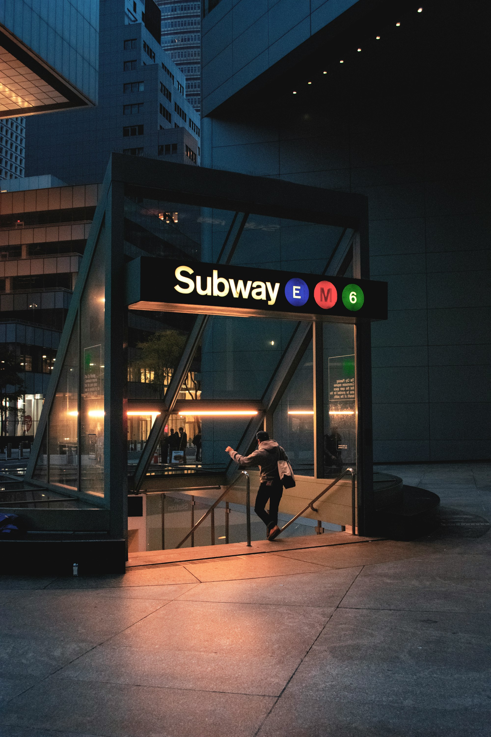
When entering a station, look for the entrance lamps resembling Poké Balls. Most subway entrances have these lamps, while prominent stations may not require them for identification.
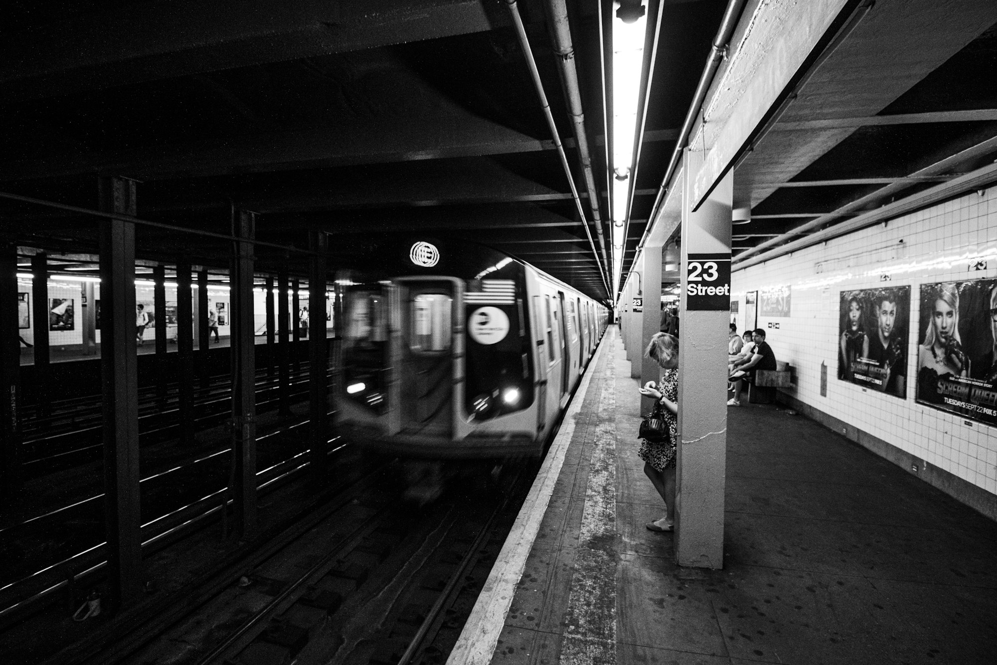
Entrance signage provides valuable information. For example, an entrance labeled "23rd Street Station" serves only the 1 train and exclusively offers downtown train access. Signs may indicate whether an entrance leads to uptown or downtown trains and the Bronx and Brooklyn directions. Some entrances accommodate trains traveling in both directions. Pay attention to these signs to ensure you enter the correct station in your intended direction.
In conclusion, it's an understatement to say that the New York City subway has a steep learning curve. However, it becomes efficient and effective transportation throughout the city once you grasp its intricacies. Don't be intimidated; the effort invested in understanding the subway pays off in the long run.


Comments ()